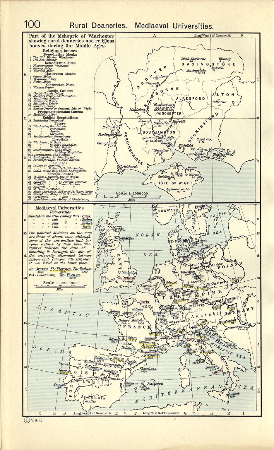
Berkas:Map of Medieval Universities.jpg
Loncat ke navigasi
Loncat ke pencarian

Ukuran pratayang ini: 685 × 599 piksel. Resolusi lainnya: 274 × 240 piksel | 549 × 480 piksel | 878 × 768 piksel | 1.127 × 986 piksel.
Ukuran asli (1.127 × 986 piksel, ukuran berkas: 574 KB, tipe MIME: image/jpeg)
| Deskripsi |
Deutsch: Karte der mittelalterlichen Universitäten
English: Map of medieval universities |
| Tanggal | |
| Sumber | William R. Shepherd: Historical Atlas, New York, Henry Holt and Company, 1923, in the Public Domain (also to be found in the 1911 edition, p. 100) |
| Pembuat |
William Robert Shepherd |
|
This work is in the public domain in its country of origin and other countries and areas where the copyright term is the author's life plus 70 years or fewer. | |
| Berkas ini telah diidentifikasi bebas dari pembatasan menurut hukum hak cipta termasuk semua hak terkait dan relevan. | |
Riwayat berkas
Klik pada tanggal/waktu untuk melihat berkas ini pada saat tersebut.
| Tanggal/Waktu | Miniatur | Dimensi | Pengguna | Komentar | |
|---|---|---|---|---|---|
| terkini | 8 Juli 2022 19.23 | | 1.127 × 986 (574 KB) | wikimediacommons>Longsars | Better Quality |
Penggunaan berkas
Halaman berikut menggunakan berkas ini: